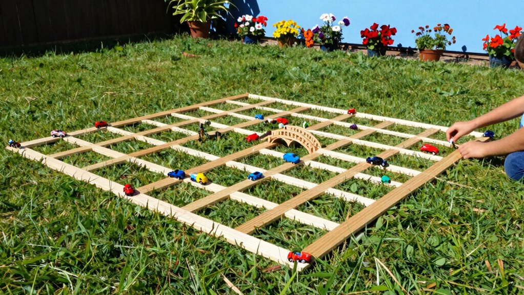

By creating backyard grid maps, you can turn everyday outdoor play into engaging STEM activities. Use tape, chalk, or natural features to establish a grid and add obstacles or goals. Kids can program small robots or smartphones to navigate the grid, improving their spatial reasoning, problem-solving, and coding skills. These activities make learning fun and interactive. Keep exploring to discover more ways to transform outdoor spaces into dynamic STEM playgrounds.
Key Takeaways
- Backyard grid maps transform outdoor play into interactive STEM learning by visualizing spatial relationships and navigation challenges.
- They enable hands-on robotics activities, teaching programming, sensors, and decision-making in a fun outdoor environment.
- Modifying grid maps encourages problem-solving, critical thinking, and iterative learning through obstacle addition or goal changes.
- Using simple materials like tape or chalk makes creating and adapting grids accessible for everyday outdoor spaces.
- Incorporating environmental features and outdoor exploration enhances holistic STEM understanding and promotes curiosity.
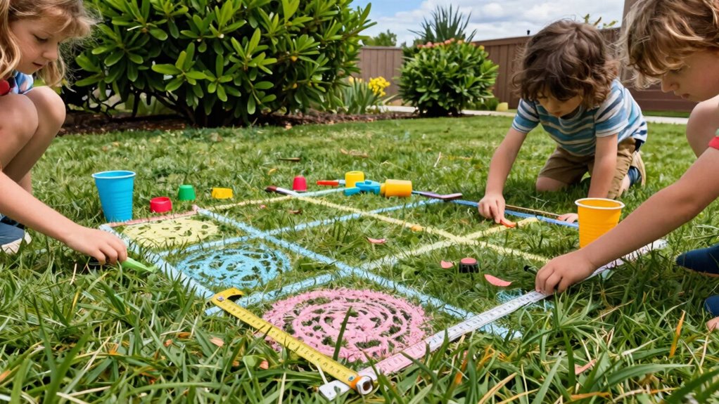
Have you ever wondered how to transform your backyard into a well-organized space? Using backyard grid maps can turn ordinary play into engaging STEM practice, especially for kids eager to explore robotics and problem-solving. Imagine designing a plan where a small robot can navigate your backyard, finding its way around obstacles and reaching specific points—this is where robotic navigation and spatial reasoning come into play. Setting up a grid map allows your children to visualize their outdoor environment as a series of interconnected squares, making it easier to understand how robots interpret space and move intelligently within it.
Transform your backyard into a STEM playground with grid maps, boosting kids’ spatial reasoning and robotics skills through fun, outdoor exploration.
When you introduce backyard grid maps, you’re giving kids a hands-on way to develop spatial reasoning skills. They learn to analyze their environment, recognize patterns, and plan routes—skills that are fundamental to robotics and many STEM fields. By creating a simple grid on the ground with tape or chalk, they can map out the yard, marking obstacles, pathways, and target zones. This active engagement helps them grasp concepts like coordinate systems, distances, and spatial relationships. It’s a playful approach that makes learning intuitive and fun.
Robotic navigation becomes more tangible when children see how a robot might use a grid map to move. You can encourage them to program small robots or even smartphone-controlled vehicles to follow specific routes on the grid. As they test and adjust their plans, they’ll learn about sensor input, decision-making, and how robots interpret spatial information. These exercises sharpen their critical thinking and introduce them to foundational robotics concepts in a relaxed, outdoor setting. Plus, it’s exciting to watch a robot successfully navigate around the yard, demonstrating how theoretical ideas translate into real-world actions.
The beauty of backyard grid maps is their flexibility. You don’t need fancy equipment—just some tape, chalk, or natural features to create boundaries. Kids can modify their maps as they learn, adding new obstacles or goals to challenge their robot’s navigation skills. This iterative process reinforces problem-solving and encourages creativity. As they experiment, they develop a deeper understanding of how spatial reasoning guides movement and decision-making, laying the groundwork for more advanced STEM concepts later on. Additionally, understanding the role of biodiversity in their local environment can inspire more holistic outdoor projects.
In short, transforming your backyard into a space for robotic navigation and spatial reasoning through grid maps makes learning active and meaningful. It’s a simple yet powerful way to foster curiosity, critical thinking, and technical skills—all while enjoying outdoor play. You’re not just creating a fun environment; you’re setting the stage for your children to explore the fascinating worlds of robotics and science, right in your own backyard.
As an affiliate, we earn on qualifying purchases.
Frequently Asked Questions
What Materials Are Best for Creating Backyard Grid Maps?
You should choose lightweight, weather-resistant materials like corrugated plastic or waterproof tape for your grid map design. These materials offer excellent material durability, ensuring your map withstands outdoor conditions. Using materials that are easy to cut and secure makes setup simple and quick. Avoid flimsy options like paper or fabric, as they won’t last outdoors. Durable, weatherproof materials help your backyard grid maps stay intact and functional over time.
How Can I Adapt Grid Maps for Different Age Groups?
Think of your backyard as a storybook, with each age group acting as different characters. To adapt grid maps, craft age-appropriate challenges that spark curiosity and encourage problem-solving. For younger kids, use simple symbols and interactive learning games, while older children can tackle more complex maps with layered tasks. By tailoring the difficulty, you turn outdoor play into a meaningful, engaging experience that grows with their skills.
What Safety Precautions Should I Consider During Activities?
You should always prioritize safety by using appropriate safety gear, like helmets or knee pads, especially during active or outdoor activities. Follow supervision guidelines strictly, ensuring an adult is present to monitor children’s play and intervene if needed. Keep the area clear of hazards, and teach kids about safe play practices. This way, you create a safe environment where kids can explore, learn, and enjoy STEM activities without unnecessary risks.
Are There Digital Tools to Complement Physical Grid Maps?
Yes, you can enhance your experience with digital tools like augmented reality and digital integration. Imagine transforming your physical grid maps into interactive adventures by scanning them with AR apps, revealing hidden clues or guiding you through new challenges. These tools bring your backyard play to life, making STEM learning even more exciting. With the right technology, you’ll discover a whole new world where digital and physical adventures collide seamlessly.
How Can I Incorporate Local Wildlife Into the Maps?
You can incorporate local wildlife into your maps by engaging in wildlife tracking and habitat identification. Observe and record animals you see, noting their behaviors and habitats. Use symbols or colors to represent different species and their preferred environments. This approach helps you connect with nature, enhances your understanding of local ecosystems, and makes your grid maps more dynamic and educational. It’s a fun way to combine outdoor exploration with STEM learning.
Conclusion
By creating backyard grid maps, you turn ordinary play into exciting STEM adventures, much like transforming a blank canvas into a vibrant masterpiece. You’ll see kids explore problem-solving, spatial awareness, and creativity all in one activity. Just as a gardener tends to each plant, you nurture curiosity and learning right outside your door. So, grab your supplies and watch your backyard become a lively classroom where curiosity blooms like colorful flowers in spring.